Publications
Climate-driven global redistribution of an ocean giant predicts increased threat from shipping
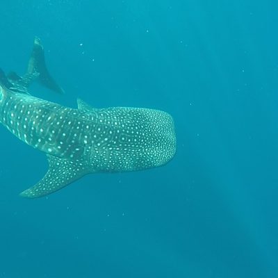
GSMP uses global climate models and habitat suitability estimated from long-term satellite-tracking data of the world’s largest fish, the whale shark, to show that redistributions of present-day habitats are projected to increase the species’ co-occurrence with global shipping. Our model projects core habitat area losses of >50% within some national waters by 2100, with geographic shifts of over 1,000 km (∼12 km yr−1). Greater habitat suitability is predicted in current range-edge areas, increasing the co-occurrence of sharks with large ships. This future increase was ∼15,000 times greater under high emissions compared with a sustainable development scenario. Results demonstrate that climate-induced global species redistributions that increase exposure to direct sources of mortality are possible, emphasizing the need for quantitative climate-threat predictions in conservation assessments of endangered marine megafauna.
PUBLICATION:

Shipping is on the rise: four steps to curb 'ocean roadkill'
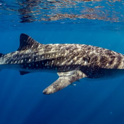
There is increasing evidence that ship strikes are a major cause of mortality for whales, sharks and other ocean giants. With the global fleet growing, GSMP researchers propose some simple actions that can turn things around.
PUBLICATION:

Global collision-risk hotspots of marine traffic and the world’s largest fish, the whale shark
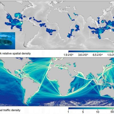
We combine satellite-tracked movements of the whale shark, Rhincodon typus, and vessel activity to show that 92% of sharks’ horizontal space use and nearly 50% of vertical space use overlap with persistent large vessel (>300 gross tons) traffic. Collision-risk estimates correlated with reported whale shark mortality from ship strikes, indicating higher mortality in areas with greatest overlap. Depth-recording tags provided evidence for sinking, likely dead, whale sharks, suggesting substantial “cryptic” lethal ship strikes are possible, which could explain why whale shark population declines continue despite international protection and low fishing-induced mortality.
PUBLICATION:

Reply to: Shark mortality cannot be assessed by fishery overlap alone
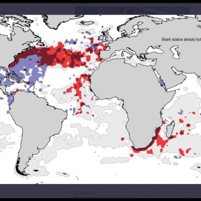
We confirm—using regression analysis of spatially matched data—that fishing-induced pelagic shark mortality (catch per unit effort (CPUE)) is greater where Fishing Exposure Index is higher
PUBLICATION:

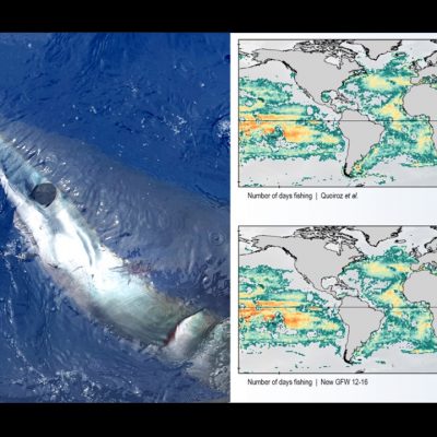
Reply to: Caution over use of ecological big-data for conservation
Here we demonstrate that even using much larger numbers of vessel reclassifications (misclassified vessels) the central results and conclusions of our paper do not change
PUBLICATION:

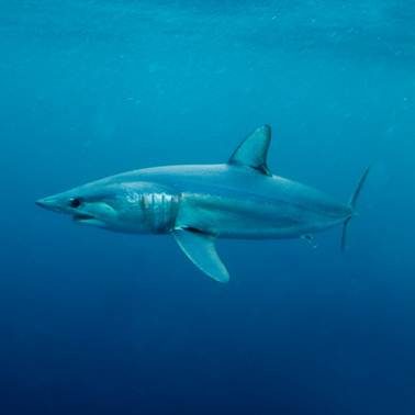
Shortfin mako sharks speeding to the brink
The world’s fastest shark, the shortfin mako (Isurus oxyrinchus), is globally endangered but remains overfished in the North Atlantic and in high demand commercially for its meat and fins. Even with zero retention, reducing capture and post-release mortalities will be necessary. An annual mortality of 1100 tons, already greatly exceeded in 2019, gives only an 8% chance of rebuilding by 2070.
PUBLICATION:

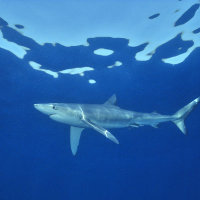
Climate-driven deoxygenation elevates fishing vulnerability for the ocean’s widest ranging shark
Here, analysis of satellite-tracked blue sharks and environmental modelling in the eastern tropical Atlantic oxygen minimum zone (OMZ) shows shark maximum dive depths decreased due to combined effects of decreasing dissolved oxygen (DO) at depth, high sea surface temperatures, and increased surface-layer net primary production. Fisheries controls to counteract deoxygenation effects on shark catches will be needed as oceans continue warming.
PUBLICATION:

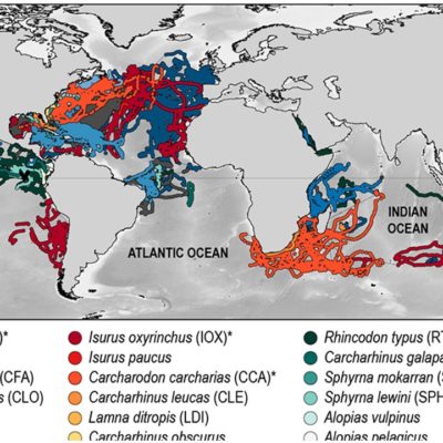
Global spatial risk assessment of sharks under the footprint of fisheries
Effective ocean management and the conservation of highly migratory species depend on resolving the overlap between animal movements and distributions, and fishing effort. However, this information is lacking at a global scale. Here we show, using a big-data approach that combines satellite-tracked movements of pelagic sharks and global fishing fleets, that 24% of the mean monthly space used by sharks falls under the footprint of pelagic longline fisheries. Space-use hotspots of commercially valuable sharks and of internationally protected species had the highest overlap with longlines (up to 76% and 64%, respectively), and were also associated with significant increases in fishing effort. We conclude that pelagic sharks have limited spatial refuge from current levels of fishing effort in marine areas beyond national jurisdictions (the high seas). Our results demonstrate an urgent need for conservation and management measures at high-seas hotspots of shark space use, and highlight the potential of simultaneous satellite surveillance of megafauna and fishers as a tool for near-real-time, dynamic management.
PUBLICATION:

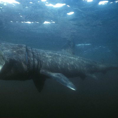
Trade in mislabeled endangered sharks
To regulate mislabeled illegal products, CITES signatory nations must allocate sufficient resources to coordinate species identification methods for fast, routine monitoring of shark products across borders. Financial and knowledge resources will need to be made available to help some nations achieve this. Without these coordinated global actions, the future of endangered pelagic sharks remains precarious.
PUBLICATION:

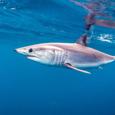
Shortfin mako sharks threatened by inaction
Action taken so far by managers will not halt the decline of North Atlantic shortfin mako sharks. Even if total catches decrease to 500 tons, probability of stock rebuilding by 2040 is only 35%, rising to 54% for zero catch. Thus, recovery will be very slow even if prohibition can be agreed upon and, importantly, is enforced.
PUBLICATION:

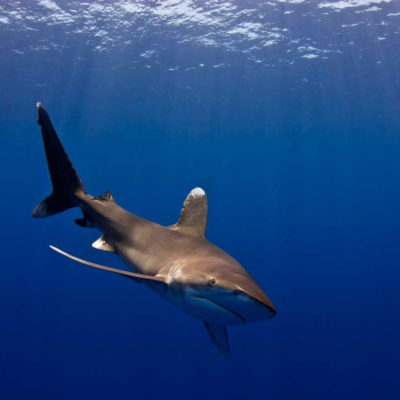
Ocean-wide tracking of pelagic sharks reveals extent of overlap with longline fishing hotspots
Using satellite tracking data from six shark species across the North Atlantic, we show that pelagic sharks occupy predictable habitat hotspots of high space use. Movement modeling showed sharks preferred habitats characterized by strong sea surface-temperature gradients (fronts) over other available habitats. However, simultaneous Global Positioning System (GPS) tracking of the entire Spanish and Portuguese longline-vessel fishing fleets show an 80% overlap of fished areas with hotspots, potentially increasing shark susceptibility to fishing exploitation. Regions of high overlap between oceanic tagged sharks and longliners included the North Atlantic Current/Labrador Current convergence zone and the Mid-Atlantic Ridge southwest of the Azores. In these main regions, and subareas within them, shark/vessel co-occurrence was spatially and temporally persistent between years, highlighting how broadly the fishing exploitation efficiently “tracks” oceanic sharks within their space-use hotspots year-round. Given this intense focus of longliners on shark hotspots, our study argues the need for international catch limits for pelagic sharks and identifies a future role of combining fine-scale fish and vessel telemetry to inform the ocean-scale management of fisheries.
PUBLICATION:


